Manaslu Tsum Valley Trek
Manaslu Tsum Valley Trek: Trip Snapshot
Essential snapshot of the Manaslu Tsum Valley Trek, highlighting route length, elevations, and conditions
About the Manaslu Tsum Valley Trek
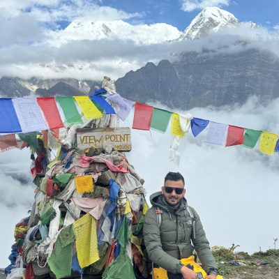
The Manaslu Tsum Valley trek is a soulfully combined cultural and high-mountain journey through Nepal’s quiet northern peaks. It isn't a race to the top; instead, it focuses on moving slowly through the Manaslu region restricted trekking region. This controlled access keeps the traditional villages and wild landscapes feeling incredibly preserved and peaceful.
Choosing the Tsum Valley with Manaslu Circuit adds a deep cultural detour into the sacred Tsum valley before returning to the main trail. This route prioritizes ancient monasteries, village life, and spiritual heritage over constant climbing and elevation gain. It offers a truly remote Himalayan trekking in Nepal experience that feels deeply personal and immersive.
The trek perfectly balances high-altitude cultural richness with the Tsum Valley Cultural Trek Nepal experience. Passing through ancient Buddhist villages and monasteries, and watching daily rituals makes it one of the most authentic off the beaten path treks in Nepal. It’s the ideal choice for those who value spiritual depth over a purely physical challenge.
Manaslu Tsum Valley Trek Itinerary: 19-Day Route
Show AllDay 01: Drive from Kathmandu to Machha Khola
-
 Elevation: ~900 m (Machha Khola)
 -
 Duration: 6–7 hours
Day 02: Trek from Machha Khola to Jagat
-
Elevation: ~1,340 m (Jagat)
-
Duration: 6–7 hours
Day 03: Jagat to Lokpa (Entering Tsum Valley)
-
Elevation: ~2,040 m (Lokpa Village)
-
Duration: 6–7 hours
Day 04: Lokpa to Chumling Village
-
Elevation: ~2,386 m (Chumling Village)
-
Duration: 5–6 hours
Day 05: Chumling to Chhekampar Village
-
Elevation: ~3,010 m (Chhekampar Village)
-
Duration: 5–6 hours
Day 06: Chhekampar to Nile
-
Elevation: ~3,360 m (Nile Village)
-
Duration: 5–6 hours
Day 07: Acclimatization Day at Nile; Hike to Mu Gompa
-
Elevation: ~3,700 m (Mu Gompa)
-
Duration: 4–5 hours
Day 08: Trek from Nile to Chumling
-
Elevation: ~2,386 m (Chumling)
-
Duration: 6–7 hours
Day 09: Chumling to Deng
-
Elevation: ~1,860 m (Deng Village)
-
Duration: 6–7 hours
Day 10: Deng to Namrung
-
Elevation: ~2,630 m (Namrung Village)
-
Duration: 6–7 hours
Day 11: Namrung to Shyala
-
Elevation: ~3,500 m (Shyala)
-
Duration: 6-7 hours
Day 12: Visit Pungen Gompa; Trek to Samagaon
-
Elevation: ~3,530 m (Samagaon)
-
Duration: 6–7 hours
Day 13: Acclimatization Day: Hike to Manaslu Base Camp
-
Elevation: ~4,800 m (Base Camp)
-
Duration: 7–8 hours
Day 14: Trek from Samagaon to Samdo
-
Elevation: ~3,875 m (Samdo Village)
-
Duration: 4–5 hours
Day 15: Samdo to Dharamsala (Larkya Phedi)
-
Elevation: ~4,460 m (Dharamsala)
-
Duration: 4–5 hours
Day 16: Cross Larkya La Pass and Trek to Bimthang
-
Elevation: 5,106 m (Larkya La Pass), ~3,590 m (Bimthang)
-
Duration: 8–9 hours
Day 17: Bimthang to Gho trek
-
Elevation: ~2,560 m (Gho)
-
Duration: 6–7 hours
Day 18: Trek from Gho to Dharapani; Drive to Besisahar
-
Elevation: ~1,860 m (Dharapani) | ~760 m (Besisahar)
-
Duration: 4–5 hours trek, 3–4 hours drive
Day 19: Drive from Besisahar to Kathmandu
-
Elevation: 1,350 m (Kathmandu)
-
Duration: 6–7 hours
Manaslu Tsum Valley Trek Route & Map Explanation
The Manaslu Tsum Valley Trek follows a remote Himalayan corridor linking the Manaslu Region with the culturally protected Tsum Valley. Entry begins from the Budhi Gandaki trailhead and exits via the Larkya La crossing. The route connects traditional villages, river systems, and gradual elevation zones within a restricted geographic setting.
Complete Manaslu Tsum Valley trekking route showing village sequence, river valleys, altitude progression, and Larkya La crossing.
The map highlights key settlements, major river corridors, and elevation flow from low valleys to high alpine terrain. It provides clear geographic context for understanding daily walking stages, acclimatization logic, and how the Tsum Valley integrates with the Manaslu Circuit route.
Life, Culture & Monasteries of the Tsum Valley
The Tsum Valley is home to some of the most preserved Tibetan Buddhist villages in Nepal. Stone-built settlements, mani walls, and prayer flags shape daily life, reflecting centuries-old spiritual traditions. Community routines remain closely tied to agriculture, livestock, and monastery-centered rituals.
Spiritual landmarks like Mu Gompa, Rachen Gompa, and Milarepa Cave form the cultural core of the valley. Trekkers often encounter Himalayan yak herders, observe prayer ceremonies, and experience a slower, deeply spiritual rhythm of mountain life.
Landscapes, Ecology & Conservation Efforts
Much of the trek passes through the Manaslu Conservation Area, known for its dramatic terrain and diverse Himalayan ecosystems. Landscapes shift from river gorges and forests to alpine meadows and glacial valleys as elevation increases.
The region supports Himalayan glaciers, wildlife habitats, and fragile mountain vegetation. Eco-friendly trekking principles such as waste control, limited resource use, and respect for local practices, are essential for responsible wilderness trekking in Nepal’s remote conservation zones.
Start Planning Your Manaslu Tsum Valley Trek with Experts
Plan your Manaslu Tsum Valley Trek with a fully licensed Nepali trekking operator that works directly in the Manaslu region. Our team handles restricted-area permits, experienced guides, porter support, and route planning with a strong focus on safety, cultural respect, and responsible trekking in remote Himalayan terrain.
If you’re ready to finalize dates, costs, or itinerary details, send us an inquiry for expert guidance tailored to your needs. For confirmed departures and transparent pricing, contact us today, or book your Manaslu Tsum Valley Trek with a trusted local team that operates on the ground, and not through third parties.
FAQs About Manaslu Tsum Valley Trek
Manaslu Tsum Valley Trek FAQs
Find answers to the most common questions about the Manaslu Tsum Valley Trek, including permits, itinerary, cost, and difficulty.
How early should I book the Manaslu Tsum Valley Trek permits and permits processing time?
You should book the Manaslu Tsum Valley Trek permits at least 2–3 weeks in advance. The permits processing time is usually 1–2 working days once documents are submitted.
Is it possible to customize the Manaslu Tsum Valley Trek itinerary?
Yes, it is possible to customize the Manaslu Tsum Valley Trek itinerary. Most operators allow changes to trek duration, acclimatization days, Tsum Valley side trips, and walking pace, as long as the customized itinerary follows restricted area permit rules and guide requirements.
Can I hire a porter or yak support for the Manaslu Tsum Valley Trek?
Yes, you can hire a porter or yak support for the Manaslu Tsum Valley Trek. Porters are commonly used on the Manaslu route, while yak support is available in Upper Tsum Valley and Manaslu high-altitude sections.
What mobile network or internet connectivity can I expect along the Manaslu Tsum Valley Trek?
Mobile network or internet connectivity along the Manaslu Tsum Valley Trek is limited. Basic mobile signals may work in lower villages, but Upper Tsum Valley and high sections have no coverage. Some teahouses offer paid Wi-Fi, but reliability is inconsistent.
Are there ATM or cash withdrawal points on the Manaslu Tsum Valley Trek route?
No, there are no ATM or cash withdrawal points on the Manaslu Tsum Valley Trek route. You must carry sufficient cash from Kathmandu to cover accommodation, food, charging, Wi-Fi, tips, and emergencies throughout the entire trekking route.
What languages do local people speak along Tsum Valley villages?
Along Tsum Valley villages, local people primarily speak Tsumba (a Tibetan dialect). Nepali is widely understood, and basic communication in Tibetan-influenced languages is common, especially around monasteries and older settlements.
How safe is the drinking water and food hygiene along the Manaslu Tsum Valley Trek?
Drinking water and food hygiene along the Manaslu Tsum Valley Trek are generally safe in teahouses, but untreated water should be purified. Using water purification tablets or filters is strongly recommended.
What emergency evacuation options are available on the Manaslu Tsum Valley Trek?
Emergency evacuation options on the Manaslu Tsum Valley Trek include helicopter evacuation arranged through trekking agencies. Evacuation depends on weather conditions, landing access, and insurance coverage.
Can children or teenagers safely attempt the Manaslu Tsum Valley Trek?
Yes, children or teenagers can safely attempt the Manaslu Tsum Valley Trek if they are physically fit, accompanied by guardians, and follow a proper acclimatization itinerary.
How do weather patterns affect the Larkya La Pass crossing?
Weather patterns affect the Larkya La Pass crossing significantly. Snowfall, strong winds, and poor visibility can delay or block the pass. Stable weather windows in spring and autumn provide safer conditions for the high-altitude crossing.