Kanchenjunga Circuit Trek
Kanchenjunga Circuit Trek: Trip Overview
Key facts and logistics for planning the Kanchenjunga Circuit Trek
About the Kanchenjunga Circuit Trek
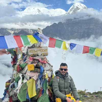
The Kanchenjunga Circuit Trek is one of Nepal’s most remote and least-traveled high-altitude journeys, circling the massive Kanchenjunga Himal, the world’s third-highest mountain. This trek traverses deep valleys, glacial basins, and high mountain passes in eastern Nepal, connecting both the Kanchenjunga North Base Camp (Pangpema) and Kanchenjunga South Base Camp (Oktang) into a complete circuit.
It is considered a restricted and remote trek due to its location inside the Kanchenjunga Conservation Area, limited infrastructure, and proximity to international borders. The route passes through sparsely populated regions influenced by Tibetan Buddhist culture, as well as traditional Limbu and Rai communities, offering an experience far removed from commercial trekking corridors.
This trek is best suited for trekkers seeking off-the-beaten-path treks in Nepal, long-duration wilderness travel, and authentic mountain environments rather than lodge-to-lodge comfort. Compared to the Annapurna Circuit Trek or Everest Base Camp Trek, Kanchenjunga is quieter, more logistically demanding, and far less crowded—making it ideal for those prioritizing solitude, scale, and raw Himalayan landscapes over accessibility.
Kanchenjunga Circuit Trek Itinerary (Day-by-Day)
Show AllDay 1: Fly from Kathmandu to Bhadrapur, drive to Ilam
-
 Elevation: 1,200 m
 -
 Duration: 45 min flight + 3-4 hrs drive
Day 2: Drive from Ilam to Taplejung
-
Elevation: ~1,820 m
-
Duration: 5-6 hours
Day 3: Taplejung to Sekathum – enter Kanchenjunga Conservation Area
-
Elevation: 1780 m
-
Duration: 5 - 6 hours
Day 4: Sekathum to Amjilosa
-
Elevation: 2390 m
-
Duration: 4 -5 hours
Day 5: Amjilosa to Gyabla
-
Elevation: ~2,750 m
-
Duration: 5 -6 hours
Day 6: Gyabla to Ghunsa
-
Elevation: ~3,430 m
-
Duration: 4–5 hours
Day 7: Acclimatization day in Ghunsa (short hikes)
-
Elevation: ~3,430 m
-
Duration: 3–4 hours
Day 8: Ghunsa to Khambachen
-
Elevation: ~4,050 m
-
Duration: 5 - 6 hours
Day 9: Khambachen to Lhonak
-
Elevation: ~4,780 m
-
Duration: 4–5 hours
Day 10: Lhonak to Pangpema (Kanchenjunga North Base Camp)
-
Elevation: ~5,140 m
-
Duration: 5–6 hours
Day 11: Pangpema exploration; return to Lhonak
-
Elevation: ~4,780 m
-
Duration: 4–5 hours
Day 12: Lhonak to Ghunsa
-
Elevation: ~3,430 m
-
Duration: 5–6 hours
Day 13: Ghunsa to Sele La
-
Elevation: ~4,480 m
-
Duration: 4–5 hours
Day 14: Sele La to Cheram via Sinion La, Mirgin La & Sinelapche La
-
Elevation: ~4,900 m
-
Duration: 6–7 hours
Day 15: Cheram to Ramche
-
Elevation: ~4,580 m
-
Duration: 3–4 hours
Day 16: Ramche to Yalung (South Base Camp); return to Cheram
-
Elevation: ~4,700 m
-
Duration: 5–6 hours
Day 17: Cheram to Tortong
-
Elevation: ~3,000 m
-
Duration: 3–4 hours
Day 18: Tortong to Yamphudin
-
Elevation: ~2,080 m
-
Duration: 6–7 hours
Day 19: Yamphudin to Ilam
-
Elevation: ~1,200 m
-
Duration: 6–7 hours
Day 20: Drive to Bhadrapur; fly back to Kathmandu
-
Elevation: ~1,340 m
-
Duration: 3 - 4 hr drive + 45 min flight
Kanchenjunga Circuit Trek Route & Map
The Kanchenjunga Circuit Trek route explores the far eastern Himalaya of Nepal, progressing from the lowland plains of Bhadrapur through the hills of Ilam and Taplejung, before entering the remote Kanchenjunga Conservation Area. The trail follows the Tamor River valley, gradually ascending through isolated mountain settlements such as Sekathum, Amjilosa, Gyabla, and Ghunsa, as it circles Mount Kanchenjunga (8,586 m)—the world’s third-highest mountain. From the alpine basin of Lhonak Valley, the trek reaches its northern high point at Pangpema (Kanchenjunga North Base Camp) before traversing a demanding series of high passes to connect with the southern Yalung Glacier and Kanchenjunga South Base Camp.
Kanchenjunga Circuit Trek route map illustrating the Tamor River valley, key villages such as Ghunsa and Lhonak, Pangpema (North Base Camp), the high-pass crossings via Sele La, and the southern exit toward Yalung and Yamphudin.
This visual Kanchenjunga Circuit Trek map clarifies the trek’s dual base camp structure, complex altitude progression, and logistical flow across one of Nepal’s most isolated trekking regions. It helps trekkers understand why acclimatization in Ghunsa is essential before committing to the high-pass section that links the north and south faces of the Kanchenjunga massif, where exit options are limited and altitude exposure intensifies.
Villages & Local Life on the Kanchenjunga Circuit
The trek passes through culturally rich settlements in eastern Nepal, shaped by Limbu and Rai communities in lower valleys and Tibetan Buddhist culture at higher altitudes. Villages remain rooted in subsistence farming, yak herding, and seasonal trade, offering an authentic Himalayan lifestyle largely untouched by mass tourism.
In the Ghunsa Valley, stone houses, prayer flags, ancient monasteries, carved mani walls, and whitewashed chortens reflect living traditions. These elements are part of daily life, highlighting the region’s spiritual depth and enduring cultural continuity.
Accommodation & Food on the Kanchenjunga Circuit Trek
Accommodation on the Kanchenjunga route follows a teahouse trekking model, though facilities are simpler than on Annapurna or Everest trails. Family-run lodges offer basic twin rooms, shared toilets, minimal heating, and communal dining. Beyond Ghunsa and Khambachen, stays become more rustic, reflecting the region’s remoteness and logistical challenges.
Food is reliable but limited at higher altitudes, focusing on staples like dal bhat, noodles, soups, potatoes, and seasonal vegetables. Hygiene is generally good, but trekkers should follow guide advice and use water purification for a safe high-altitude trekking experience.
Flora, Fauna & Conservation Areas
The trek passes entirely through the Kanchenjunga Conservation Area, Nepal’s largest protected region, spanning subtropical valleys to alpine terrain. Lower sections feature rhododendron forests, bamboo groves, and mixed hardwoods, while higher elevations shift to juniper scrub, alpine meadows, and glacial landscapes near base camps and high passes.
This zone supports rare wildlife such as snow leopards, red pandas, Himalayan black bears, and blue sheep, though sightings are rare. Responsible trekking practices, such as minimizing waste, respecting habitats, and supporting local lodges, are essential to protect this fragile and restricted ecosystem.
Is the Kanchenjunga Circuit Trek Suitable for Beginners?
The Kanchenjunga Circuit Trek is not recommended for absolute beginners due to its remote terrain, long duration, and high altitudes. However, physically fit first-time high-altitude trekkers can attempt it with proper preparation and a professional guide.
- Required Experience Level: Trekkers should be comfortable walking 6–8 hours daily on rugged trails, carrying a daypack, and navigating sustained ascents above 3,500 m, including passes like Sele La and Sinelapche La.
- Preparation Expectations:
- Engage in cardio, leg-strength, and endurance training 6–8 weeks prior
- Practice trekking with a daypack and moderate elevation gains
- Include rest and acclimatization days in the itinerary
- Trek Suitability Considerations: The trek demands strong physical endurance, altitude discipline, and mental resilience. Solo attempts are discouraged; guided treks enhance safety and success.
FAQs About Kanchenjunga Circuit Trek
Book Your Kanchenjunga Circuit Trek with Licensed Expert Guides
Join our Kanchenjunga Circuit Trek guided by professionals with high-altitude expertise, local knowledge, and official permits. From preparation to final descent, we handle safety and logistics so you can focus on the adventure. Book now to secure your spot and journey through Nepal’s untouched Himalayas. Contact our experts for more details.
What’s Included and Excluded
This cost and inclusion are based on standard group bookings. If you are not satisfied with the itinerary or package includes details, please contact us, we are happy to customize the trek according to your preferences.
Kanchenjunga Circuit Trek FAQs
Find answers to the most common questions about the Kanchenjunga Circuit Trek, including permits, itinerary, cost, and difficulty.
Is the Kanchenjunga Circuit Trek suitable if I’ve never done a restricted area trek before?
No. The Kanchenjunga Circuit Trek is not suitable for trekkers who have never done a restricted area trek before. First-time restricted area trekkers need prior trekking experience, high-altitude preparation, and a licensed guide to safely complete the trek.
Why is the Kanchenjunga Circuit Trek considered more remote than Everest or Manaslu?
The Kanchenjunga Circuit Trek is considered more remote than Everest or Manaslu because it passes through fewer villages, limited teahouses, and a restricted area. Trekkers experience extended solitude, challenging terrain, and authentic Himalayan culture along the Kanchenjunga route.
What makes the Kanchenjunga Circuit Trek physically harder than other long treks?
The Kanchenjunga Circuit Trek is physically harder than other long treks due to steep ascents, multiple high passes, long daily walking hours, and limited infrastructure. Trekkers must maintain endurance and stamina to complete the Kanchenjunga trek safely.
Do tea houses on the Kanchenjunga Circuit provide enough food variety at higher altitudes?
Yes. Tea houses on the Kanchenjunga Circuit provide enough food variety at higher altitudes for trekkers. Meals focus on staples like dal bhat, noodles, and soups, but tea houses at higher altitudes have limited menus, so personal snacks are advised.
Is phone signal or internet available during the Kanchenjunga Circuit Trek?
No. Phone signals and internet are not reliably available during the Kanchenjunga Circuit Trek. Mobile networks work intermittently in lower villages, while signal and internet are mostly absent in remote high-altitude areas along the Kanchenjunga trail.
How cold does it actually get on the Kanchenjunga Circuit compared to Everest Base Camp?
The Kanchenjunga Circuit Trek is colder than Everest Base Camp, especially at night and near Pangpema. Temperatures can drop below –10°C, with strong winds and frost, so trekkers need proper warm clothing for this trek.
Can the Kanchenjunga Circuit Trek be shortened if someone struggles midway?
Yes. The Kanchenjunga Circuit Trek can be shortened if someone struggles midway. Options are limited due to remoteness, but trekkers can descend to Ghunsa or Ilam safely with a licensed guide during the remote tre
Why is choosing a Kanchenjunga-experienced agency more important than price?
Choosing a Kanchenjunga-experienced agency is more important than price because only experienced agencies can navigate the restricted area, ensure safety, manage permits, and provide emergency support. Trekkers benefit from expert local guidance over cost savings.